Monday, June 3, 2019

Research in Genoa


June 3, 2019

Greetings from Genoa!

This is my first time blogging from this city (my first real visit, since I’m not counting the ten minutes I spent switching trains last summer), but I’m excited to experience Italian city life. Last year, I spent four weeks in the mountains of northern Italy, contributing to the excavation of a paleolithic site. Since then, I’ve managed to complete my final year at CU Denver and graduate with a Master’s degree. With that part of my training finished, I’m using my newfound expertise to analyze materials excavated over the last three years. No pressure or anything.

Fireworks from Republic day (June 2, Genoa)

Subsequently, two days after my graduation, and during a snowstorm (this erratic weather pattern is common to Colorado), I began my flight to Europe. I should probably have suspected something after I received a terminal ticket to Munich (instead of Genoa), but I was rather exhausted from the end of the semester, visiting family, graduation, and packing everything I owned for my August move, and didn’t think anything of it. Upon my arrival in Amsterdam, I discovered I was rerouted to Munich because my original flight to Genoa had been canceled, and my rebooked flight from Munich-Genoa was already canceled (due to strikes in Italy). I went to Munich anyway, because I figured at least it would be a shorter train ride if necessary, and the airline promptly lost my luggage. Luckily, this was only my clothes and not the plethora of research equipment I was bringing. Even better, I was issued a ticket for the following day, and a bed for the night.

I was quite relieved to watch the plane float over the rugged Italian coastline and land in Genoa without any further complications. My backpack was even waiting for me at the luggage claim.


Genoa is unlike any city I’ve traveled through. Most of the buildings are giant square blocks with banks of windows, often five, six, seven stories tall, stretching along the coastline and ascending the side of the mountains. The effect is that short buildings are suddenly revealed as massive, and sheer drops, steep walls, and stunning views of the city are a daily part of life. It’s breathtaking to stand at the height of rooftop gardens and know that the building falls away for six stories below you. Winding cobble paths connect the major thoroughfares to the apartments, busy streets swarm with pedestrians and vehicles. Many of the buildings here are old, far older than most occupied cities in the Americas. Despite the towering architecture, vegetation is abundant, from mossy paths, to the vines clinging to fences, rooftop gardens, and rows of trees lining sidewalks and shadowing the roads. A thriving port borders the coastline, extending anthropogenic activities over the sparkling waves.


My daily walk to the University


Most of my work takes place at the University of Genoa. The university (est. 1481) is two blocks from the port, and surrounded by similarly historical buildings. It is possible to wander extensively through the university, although this might have more to do with my propensity for becoming lost, and the numerous passages threading throughout the building. I know this because I became slightly misplaced trying to find the paleo laboratory. A word of caution: elevators are not for the claustrophobic, although they are fun to ride.

The lab itself is tucked under one of the buildings and is the most interesting lab I’ve set foot in. Despite whitewashed walls, it has a catacombs vibe (I’m told it was a bunker, although I’m unsure if that was the original purpose), and is larger than any other paleo/archaeology lab I’ve worked in. Each room contains several tables and is lined with shelves full of archaeological material. More archaeological finds, from multiple sites, are tucked into alcoves and the storage room, a winding narrow area at the back. Of course, it has computers and other electronic equipment, and an area to clean and sort artifacts. The only downside is the fact that the lab is naturally cave-like and chilly, but it’s similar to our South African lab in that I am constantly bundled up.

The Paleolab at the University of Genoa


The equipped lab notwithstanding, I brought some specialized equipment for faunal analysis (borrowed from the zooarchaeology lab at CU). As you can tell, this didn’t amount to much:


...But are the basics for any proper analysis. Most of those boxes contain parts of a high-tech electronic microscope and a special light that I can manipulate to look at a bone from every angle. Instant, scaled, high-resolution of photos of specimens.  Usually, I’m the only person here, (except for the student’s lab days), as our Italian colleague Fabio and students are prepping for the field season at a Neanderthal site in northwestern Italy. My goal is to pick up the analysis of the faunal material where it left off last summer, looking at the fauna both from near the burial and from the Neanderthal occupation layers. After two long semesters, it's great to be back in the lab and looking at bones. 


Saturday, April 20, 2019

Survey at Featherbeds


June 2018
Knysna, South Africa


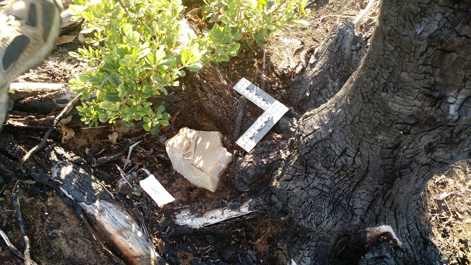
The road to Featherbeds was steep, clinging to the side of a cliff, diving through the fynbos. The green vegetation belied the destruction of the prior year, hiding the scars from the mudslides and the blackened remnants of the previous shrubs. Like a cauterizing blade, the fires had removed the imported flora from the cliffs, leaving room for the native plants, the ones that existed almost nowhere else, to bloom. In a region with the highest percentage of floral diversity, this reset was crucial. It provided a glimpse, a portal into the past, offering biologists a better understanding of the native plant life. It also provided archaeologists a chance to understand the longer-term use of Knysna. With the land cleared, an early stone age site was uncovered. One of the surveyors, Martin Hatchuel, recognized the significance of the site and contacted Dr. Cleghorn, instigating our investigation.


Beside us, the road fell away, a steep drop terminating in rocks framed by rippling waves. Beyond them was the eastern side of the Knysna heads, familiar territory. Our main excavation, a Middle/Later stone age site (~45,000-18,000 years old) was hidden among the rocks on the eastern heads, where we worked sunup to sundown five days a week. However, this Friday we wound our way up the western cliff, finally coming to rest on a flat grassy plain at the top.


As Dr. C and Martin went ahead, plunging into the fynbos, the students split up the load: camera, Total stations, GPS, and tripods, between the packs. Ironically, before we packed anything, we discovered that the site was within a stone’s throw of the road. Clutching our burdens, we picked our way across the slope, stopping to exclaim at every stone point (about every five seconds). Fascinated, we roamed across the site, cameras in hand. Early stone age tools are fascinatingly massive, handaxes larger than my hand. The average length of the tools we analyzed was 16.7cm, or 6.6 inches. And there were so many of them at Featherbed.


Soon we were setting up the GPS and the Total stations, trying to get a reading on the location. Our plan was simple: locate, take a GIS reading, and photograph every artifact we could see. This is referred to as a “catch and release” strategy. In reality, the electronic equipment proved more challenging. Out on the cliff, we were starting from scratch, without preset coordinates to compare our data. Slowly, as we worked, the site began to take shape. Landscapers had dug a ditch through down the middle of the site, dislodging and misplacing dozens of artifacts. However, clinging to the edge of the plowed slope, was the biggest handaxe most of us had ever seen. A tool that size is perhaps more symbolic than utilitarian: a work of art and showmanship.


Once a grid was established, and our equipment working, we began to number the artifacts (this is important for matching the spatial data with the analysis). One team numbered every specimen, another used the total station to capture the spatial coordinates of each artifact. A third team photographed the front and back of each find. As we wandered through the thick brush, we discovered additional tools at every turn.


The day was warm, sunlight shining off the waves. A whale breached nearby, repeatedly leaping from the water. As the sun began to fade, we packed our bags, sadly realizing there were more stone tools that we had neglected to find, hidden beneath the brush.


Early stone tools are not necessarily uncommon across the African landscape. However, they represent some of the issues with Paleoanthropology and archaeology. For example, at KEH-1, we can date the site using methods such as optically stimulated luminescence and charcoal radiometric dating. As we dig, we assess any disturbances which would displace anthropogenic finds, and use this to verify the context of our dates. One of our goals at featherbeds was to understand if the tools were in an original context, or if humans or nature had disturbed them.


So, we looked at the spatial relation of the tools and potential refits (if there are any flakes that match with cores). By we, I mostly mean our lithics people, who understand rocks and the properties of rocks. One of the downsides to a site of this age and exposure is that other material—bones, ect—generally disintegrates long before the archaeologists arrived. Our ability to refit these tools with cores suggests that the tools are in primary context and that they were abandoned/discarded at a relatively early stage of life, because there is no use damage to the tools, and humans did
not retouch (replace the edge) on any tools. So, Featherbed is a site where hominins hung out on the top of the cliff, making stone tools, possibly looking out at the unbelievably amazing wave action during warmer climatic cycles, or perhaps eyeing animals on the exposed Paleo-Agulhas Plain when the glacial periods froze the water in the polar glaciers and opened more land for use. As of right now, we have no way to date the lithics, so I am hypothesizing the possibilities based on previous research.

Post-survey celebration 


April 2019
Albuquerque, New Mexico 

But how useful is this information, unless we can share it with other researchers and the public? It represents our collective heritage and should be available for anyone to see (one of the reasons for this blog). We put together a poster to present at the Society of American Archaeology meetings, which is one of the largest gatherings of archaeologists worldwide. All of our authors were able to attend, and most of us hovered around the poster, explaining our results to unsuspecting attendees. Conferences remain an important part of the research experience--it's a way to disseminate our work (more quickly and less painfully than the extensive publishing process, and sometimes validate our existence to a university), keep track of research in our field, and network (Of course, a conference experience is not necessarily a positive one, and many people are keeping close tabs on the current controversy from the SAA meeting). Overall, this poster was a great way to wrap up our field experience. 

Stay tuned for more adventures in the coming months...I'm heading back to the field in mid-May. A few of my co-authors are joining me, others are heading off on fascinating adventures of their own. 

photo credit: G. Griffin

Photo credit: J. Hodgkins


Sunday, August 19, 2018

Arma Veirana


Photo credit: J. Hodgkins


Erli, Italy
August 4th, 2018

The drive is amazing, steep cliffs and dense brush, sharp mountains edging the skyline. We park on a narrow road, the edge of a cliff, surrounded by the pastel hues of the commune, and the vibrant shades of vegetation. Our hike begins on the gravel roads connecting multi-storied houses with the fields, descending the mountain. Soon we enter a thickly forested area, hugging the slopes as we navigate the rocky trail, a mix of pine and deciduous trees around us. The path is carpeted alternatively with leaves and strands of yellowed grass. At the base of the slope, a narrow wooden bridge spans a rushing stream. It’s easy to pause here, before beginning the climb, and imagine the shifting landscape of the past hundred thousand years. Rewind the clock, and discover the depth of human occupation: from narrow stone streets of medieval villages, to the roman expansions, and stretching into prehistoric times. Little is known of this earliest era, and our team has been tasked with investigating some of the earliest human occupations of the Arma Veirana cave.


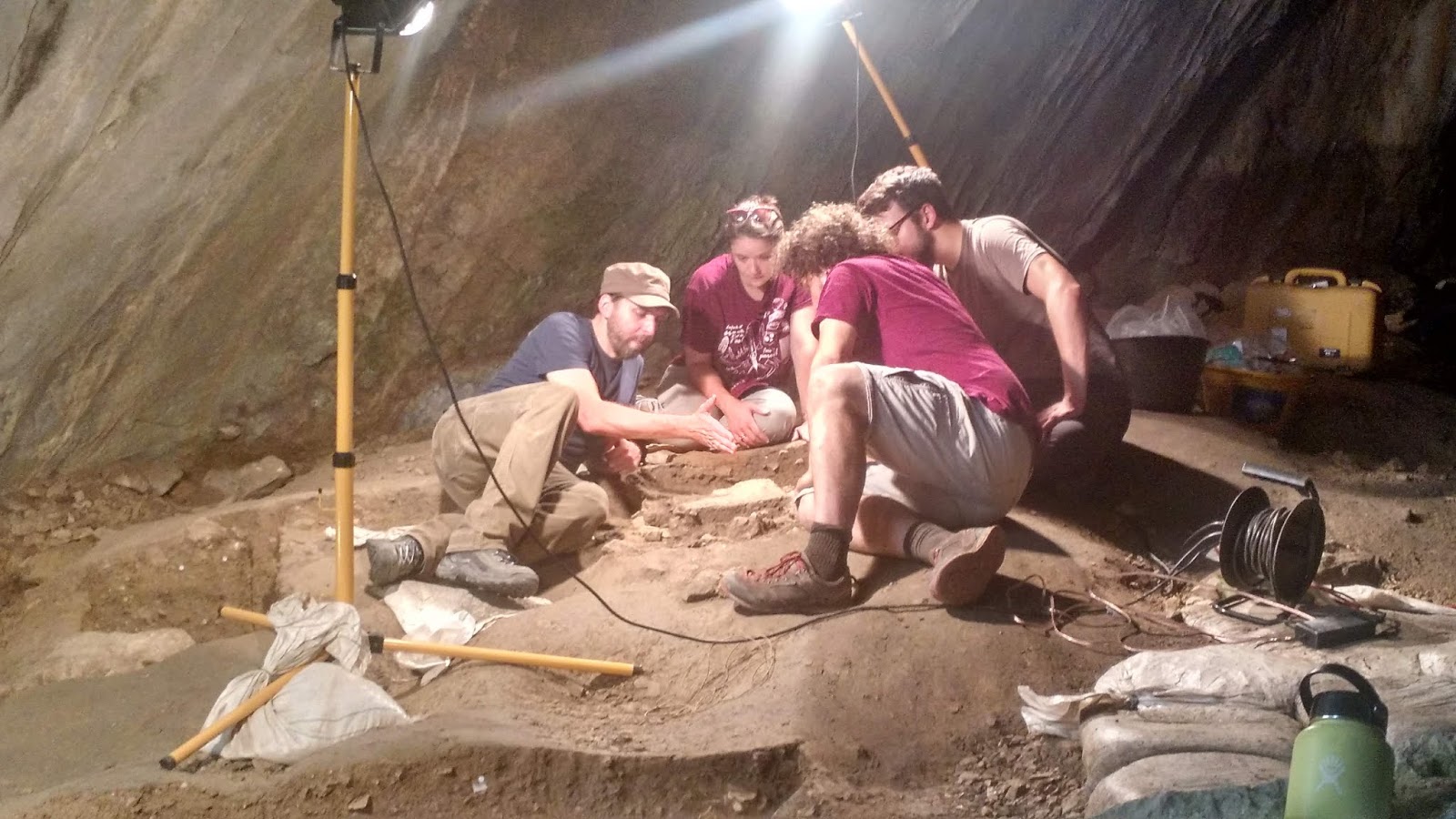
Once across the stream, we begin the climb to the cave, skirting boulders, ducking under trees and scrambling up to the cliff face. The last part is the steepest, switchbacks winding through trees and rock. The cave is sheltered by massive boulders, hiding us from casual glance. Inside, thick deposits of sediment fill the cave. Two trenches stretch across the front, surrounded by lights. The walls rise, meeting in a peak high above. Lines of speleothyms trace their way down the walls.


The earliest layers of the site contain evidence of Neanderthal occupation (Mousterian), followed by a period where homo sapiens moved in (late Epigravattian). Two pits bracketing the lower trench are remnants of looting, now connected by more-professionally excavated squares. Above them, another stepped trench bisects a washed slope. It is the open area at the top which holds everyone’s fascination: the recently discovered burial, one of three infant burials dated to this period, and the first to be discovered in the last fifty years. Each day brings exciting discoveries: fragments of bone, and grave goods in the form of pierced shells. This is amazing, because the bones can tell us more about the biological factors (how people lived and died, their health and diet), while the grave goods provide clues as to the social and cultural contexts surrounding members of the society and perceptions of life and death. Infant bones, incomplete and with softer components than adults, are less likely to survive the effects of thousands of years than would the bones of an adult, making this doubly exciting.


The dense Mousterian layers offer a variety of artifacts: lithics, bone, charcoal. We hope that analysis of this site can provide a glimpse into the Neanderthal culture and the habitat they navigated, shortly before their extinction. Other sediments lack the dense debris, suggesting an open site used by a variety of animals, including fearsome cave bears.

Cave bear incisor 


Like all archaeology projects, the work contains two components: excavation and lab work. Our lab is held in the nearby village of Erli. Every day, we hike down a mossy trail on the of slopes Erli, meandering past houses and terraced fields. Adjacent to the church is a smaller two-story building resting on the edge of a cliff. The sheer walls border the parking lot, overlooking the valley. Our lab crew gathers bagged sediment, lining it up next to the heavy iron fence. Everything must be sieved, to collect any artifacts which ended up in the buckets. Our sieve is affixed to the outside of the fence, hovering over a twenty-foot drop. This is a convenient way to rid ourselves of the sediments, the water revealing smaller finds which were hidden by thick dirt. With the start of season, our first task is to sieve all the “cleaning” buckets, loose sediments brushed from the top of the previously excavated surface. Amazing finds come out of these buckets, unfortunately, they have fallen from higher locations in site and have lost all context.

sorting sieved finds

When the finds are cleaned and dried, we move them inside the lab and spread them out on trays. Everything is then sorted into type: bone in one pile, lithics in another. These can then be cataloged and given to the experts. All the plotted finds are also washed and cataloged, creating a database which allows us to locate any artifact and its identification quickly.


artifacts waiting to be cataloged 

As the weeks slip by, the work ratchets up. The site is a collaborative effort, with researchers and students from universities in Italy, Germany, Canada, and the USA. We removed kilos of dirt, carefully from around the burial, and quickly in the more sterile layers. It is only the last week, the last day of excavation when the burial is finished. The next few days are a rush, to catalog the remaining finds and pack the lab, ensuring that everything is ready for transport to the nearby University of Genoa. With the end of summer, our excavations have ceased, but analysis will continue over the course of the year. Hopefully, we will soon understand more about the complex history of Arma Veirana.


Additional reading:


Saturday, July 7, 2018

Modern Technology and the Archaeological Record


June 22, 2018
Knysna, South Africa

“we want our excavators to stay within the [quad] lines. It’s like coloring, but with geo-spatial data.”

Tuesday was a warm day, with enormous waves rolling into the coastline, spray torn from the high white crests, to crash relentlessly against the rocks below. My task, week three, was to train our students as Site Techs. This is the person responsible for checking the geo-spatial data in the database, and making sure all electronic data (tablets, camera, ect) is backed up multiple times to many locations (okay, three). Capturing an archaeological site with all the marvels of modern technology is wonderful, until  something goes wrong and a computer crashes, the tablet is dropped, and a critical item is submersed in water. Every artifact has an associated data point captured by the total stations (“guns”) and associated with a unique barcode, so that we can go back and understand the “big-picture” view of the site. This method allows for precise, rapid and extensive amounts of data to be collected. Plus, it’s fun to manipulate the spatial data.

Keller et al. The Fauna of KEH-1 (South Africa) A Middle and Later Stone Age site: A Pilot Study. Poster presented at the 82nd Annual Meeting of the Society for American Archaeology 2018.

The day before, a tablet crashed and “deleted” more than 400 datapoints (these were later recovered), causing some consternation and stress. However, this was a minor blip compared to what was about to hit us. In order to see the location of the artifact, sometimes we need to use a crosshair fixed to paper or on the end of a rod. The correct height of the crosshair from the ground must be entered on the gun, or we have points showing up in random sequences across the map. If a gunner is switching between chits and rod, it can be easy to forget to tell the computer the correct height. The day before, one of the excavators grabbed the scanner for the wrong gun, and accidently entered a find number as a rod height of 4 million (placing the points on the other side of the moon!). Luckily, fixing this involves a simple addition/subtraction, which excel preforms for us.


Once the corrections have been entered, it is time to import everything to the map and visually check the data. This is the fun part—manipulating the three-dimensional map. Then one of my site tech trainees found what we thought was a rod error: points in unexcavated sediment. We then noticed something even more problematic: all the points were shifted, not only down, but to the right of our quads. Since our crew is not given to digging in random squares, we had a bigger problem on our hands. "Transforming" the gun makes the electronics think that it has moved position relative to the triangulated position. This is useful if you want to move the gun, less so if you are marking the positions of artifacts. It took three senior members and two trainees combing through the numbers, but eventually we discovered the sequence of events:


  • .       An excavator grabbed the wrong scanner, causing the gun to take a shot (i.e. collect a datapoint).

  • .       The gun reset itself to an earlier position.

  • .       All the following data collected was based off the assumption that the gun was somewhere it wasn’t.


As my stats professor is fond of saying, electronics are dumb, and people are smart. Once we knew what to look for, all we had to do was more math, mostly involving subtracting the actual coordinates from the fake ones (in the end, it required three grad students and a bottle of wine).


However cool the computer simulations are, the actual finds are just as fascinating. Holocene shell middens are a common scene along the coasts of south Africa. KEH-1 is no exception, with a dense and formidable layer of shell, bone, and who knows what else resting above the earlier deposits. (fortunately, the deposit is on a slope, so we can target the MSA/LSA transition we’re interested in). in our third week of excavation, we delved more deeply into the thick shell above. While our excavators were busily removing shell, our OLS specialist was preparing and removing samples. Additionally, we removed one of our oldest and well-placed gunning platforms, allowing us to dig deeper. So far, the stuff we have pulled from the lowest layers is not super exciting (mostly large chunks of rock and the occasional bits of charcoal. Excavators become jubilant when they discover anything else), but there is the potential for occupation layers contemporaneous with other sites in south Africa. And under the sediment, beneath the rock, is endless potential. At least until we hit the cave floor. 


Wednesday, June 20, 2018

Point of Human Origins


17th June, 2018

Mosselbaai, South Africa 


The wind was sharp against the cliffs, white capped waves racing to meet the sharp rocks below. Above us and around us is blue sky, the edges of the cliffs rimmed with bright green grass: the edge of the Pinnacle Point golf course.


In front of us, a gate encloses the staircase which clings tenaciously to the side of the cliff. These stairs, our guide tells us, were constructed by a local farmer, who built them in sections at his farm, then transported them on a tiny baakie (truck), swaying down the road with the wind and the weight and width of the stairs. This was before the resort, before the development and placement of the houses. In order to prevent the deaths of any students attempting to access the caves below, stairs were decidedly necessary. Survey of the Pinnacle Point sites began in 1999, during a heritage assessment for the construction. The resulting finds uncovered significant deposits, launching excavations which have lasted two decades and targeted multiple caves.

Below, halfway down the cliffs, we pause to study pale stone peeking under thick brush. It is the remnants of a speleothem and concreted sand dune, the only hint that the shattered rock on the beach below formed the roof of a massive cave. The pounding waves eventually weakened the stone, causing collapse. This is a pattern repeated frequently over hundreds of thousands of years, during the ocean recessions and incursions, creating and destroying caves.


The landscape can offer tantalizing clues to understanding early humans. Paleo reconstructions can tell us what types of landscapes humans navigated, but how and when it changed, and how humans incorporated these changes into their lifestyles and cultures. Cave 13F hints at long term environmental shifts, showcasing modifications and damage to its walls, providing a history. While it’s too low to retain archaeological deposits, which would have been washed out during a high sea stand around 130,000 years ago, the geology tells other stories. Aeolianites (concreted sand dune) trace their way up both walls, meeting speleothems. Preserved chunks of coral line the stone, reaching to the ceiling. At one point, the cave was underwater, at another, it was sealed by a sand dune. Both options rendered it inaccessible to humans, and unlikely to yield the archaeology we seek. However, the knowledge it shared of the environmental changes was invaluable.


Cave 13B rested high above 13F, high enough that sediments survived destructive waves. In addition to traces of sand dunes, it holds human occupation layers, dating from 160,000 to 90,000. Archaeologists uncovered amazing finds: early consumption of seafood and symbolic gestures. Among the shifting landscapes and the challenges, humans thrived.  


Along the rocky shoreline, other caves and remnants of caves still exist. Some of them are sterile: giant boulders covering any potential finds, others lacking any human influences. Still others have geological significance, offering a glimpse into the formation and dating of the coastline, similar to 13F. however, the real find is around the corner, through a low lying tidal zone. The sharp and steep rocks are sometimes treacherous, made slippery by the spray. We waited until low tide to creep through the lower ledges, reducing the risk of injury. Around the corner, the bay curves under massive houses, blue sky meeting blue sea, white capped waves racing towards us to collide with the rocky shoreline. At the base of the cliffs, we pause, grabbing lunch before wandering, rock to rock, through tidal pools and above the surging foam. Mussels, starfish, sea slugs and oysters await us under the dancing surface.


The next stop is rockshelter, a fault in the cliff. Once, we are told, it was a cave. The sediments preserved oddly, the water escaping from the cliffs above tearing through the inner deposits, while the waves beat at the edges. In the end, only a block of sediment preserved. Excavations spanned a sterile dune formation at 90 thousand, and again at 70 thousand, up through 50 thousand years ago, uncovering a fascinating history.


The significance of the site is not only tied up in sheltered caves, which would have offered early humans a residential area, a home base. Our next stop is a dune formation at nearby Vleesbaai. Our drive takes us through private land, across open fields, down the side of rolling hills and through dense brush. The top of the dune is covered with artifacts, disturbed from their rest, and the fossilized remains of roots poking from red, hard sand. The red layer is oxygenation from the organic matter, altering the soil after hundreds of years. But our prize is halfway down the dune, a series of hefty stairs cut into the sand. Excavations not yet covered by the constant migration of the dunes. The shelf is more stable than it looks, the sand solid. The shelf has revealed discarded stone tools, used during trips from the cave, broken, created and cast aside. Significantly, it holds crypotephra, or the tiny glass shards vomited forth by a volcano. The ones uncovered here date to the Toba supervolcano, a 74,000 year old eruption in Indonesia. This is the ultimate dating technique, offering high resolution glimpse of activity during this time. Pinnacle Point also harbors these shards—giving researchers the ability to link the sites and activities.

The dunes are harder to climb than descend, the sands pulling us down. Sometimes, it is good to take a moment, to pull our heads from the dirt, to study those who came before us. To remember the bigger picture. Humans are extremely curious—and, we wonder, were the ancient ones the same? Perhaps one day we will know.